Operational Context
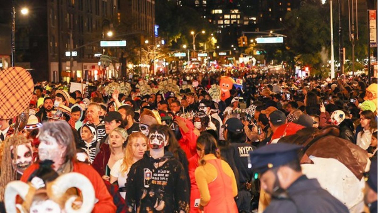
The Village Halloween Parade is one of New York City’s largest annual cultural events, typically drawing over 50,000 participants and 2 million spectators to Greenwich Village. Such citywide parades akin to the St. Patrick’s Day, Pride, and Thanksgiving parades cause full-day mobility disruptions, including road closures, parking bans, and transit diversions. While the event is highly organized and heavily policed, crowd surges, weather-related challenges, and operational delays can amplify short-term disruption across Manhattan’s core arteries.
This year’s parade coincides with a regional weather advisory (rain and gusty winds), raising moderate concern for traffic safety and event logistics.
Executive Summary
- Date of Event: 31 October 2025
- Location: Greenwich Village, Manhattan, New York City, USA
- Risk Category: Travel Risk
- Severity Level: 3 / 5
- Confidence Score: 95 %
The annual Village Halloween Parade will proceed on Friday, October 31, resulting in extensive street closures along 6th Avenue (Spring Street to 16th Street) and adjoining cross-streets. Heavy pedestrian volumes, diverted traffic, and rerouted public transport are expected from afternoon setup through early Saturday morning.
Although safety and security risks remain low, operational disruption to mobility, business logistics, and workforce movement will be substantial.
Current Updates
City authorities have confirmed street closures and diversions for the Halloween Parade on 31 October.
Closures will affect:
- 6th Avenue: Spring St → 16th St (full closure)
- Cross Streets: Canal, Broome, Houston, Bleecker, W 4th–16th
- Surrounding Routes: 7th Ave, 5th Ave, Varick St, Greenwich Ave
Public transportation agencies (MTA, NYCT) have announced reroutes for bus and subway services near the parade corridor.
Crowd management, barricades, and sanitation teams are in pre-deployment across Washington Square and Hudson Square.
Known Hotspots & Sensitive Zones
- Primary Impact Area: 6th Avenue (Spring–16th Streets)
- Crowd Hubs: Washington Square Park, Greenwich Ave, Hudson St
- Transit Congestion Points: West 4th–Washington Sq., 14th St–Union Sq. subway stations
- Peripheral Zones: SoHo, Chelsea, and West Village access roads
Impact on Transportation & Services
- Roads: Full closure of 6th Avenue and adjacent cross-streets; severe congestion on parallel routes (7th Ave, Hudson St, Varick St).
- Transit: MTA bus diversions; subway crowding near parade corridor.
- Mobility: Heavy pedestrian density; taxi/rideshare surge pricing.
- Business Operations: Reduced delivery access; limited client movement; early closures for retail.
- Emergency Access: Restricted vehicle entry; designated EMS lanes maintained along cross-routes.
Recommendations
- Workforce Mobility:
- Encourage remote work or adjusted hours for offices in lower Manhattan.
- Circulate red/amber/green access maps and transit advisories.
- Business Continuity:
- Reschedule non-critical field tasks or client visits.
- Coordinate early deliveries (before 12 PM) or post-event (after midnight).
- Asset Protection:
- Secure storefronts; avoid outdoor displays or temporary signage.
- Test CCTV and alarms; brief on-site guards on crowd management.
- Communications:
- Push internal bulletins via email/SMS on revised commute plans.
- Proactively inform clients of service delays or schedule changes.
- People Safety:
- Avoid crowd bottlenecks, skirmish lines, or flooded areas.
- Carry essentials (ID, water, power bank); keep emergency contacts updated.
Multi-Dimensional Impact
- Mobility Risk: High – gridlock and reroutes across West Village and SoHo.
- Operational Impact: Moderate – business delays and logistics rerouting.
- Safety: Low-to-moderate – minor crowd injuries possible.
- Environmental: Short-term waste accumulation and emissions from idling traffic.
- Regulatory: Fully permitted event; no compliance risks.
- Communications: Temporary mobile network congestion in parade zone.
Situation Outlook
Over the next 24 to 48 hours, large gatherings linked to the scheduled parade are expected to create temporary traffic and operational challenges across key routes. The baseline scenario anticipates that the parade will proceed as planned, with traffic reroutes, crowd management, and congestion effectively handled, leading to a peaceful conclusion of the event. A moderate escalation could occur if heavy rain or localized flooding delays the parade or hampers crowd dispersal, resulting in increased road congestion and slower emergency response times. In a severe case a security alert, extreme weather, or evacuation order could force an early termination of the event, triggering major mobility disruptions and straining emergency resources.
Emergency & Monitoring Channels
- Emergency: 911 (Immediate)
- City Alerts: Notify NYC
- Official Channels:
- NYPD News (X): @NYPDnews
- NYC DOT: @NYC_DOT
- NYC Mayor’s Office: @NYCMayorsOffice
- NYCT Subway Updates: @NYCTSubway
- NYC.gov – Official City Website
- NYC Department of Transportation (DOT)
- NYPD – New York City Police Department
Strategic Takeaway
Treat Greenwich Village and Lower Manhattan as a dynamic disruption zone on 31 October. Lead with remote operations, logistics rescheduling, and employee safety coordination. Monitor for weather-induced escalation and maintain adaptive response capability. Stay ahead of operational risks with real-time alerts, scenario modeling, and expert advisories with datasurfr’s Predict. Start your 14-day free trial of Datasurfr’s Risk Intelligence Platform today.
