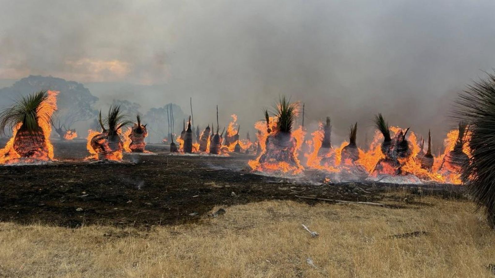
Operational Context
Western Australia regularly experiences extreme fire weather during the peak summer season, particularly across peri-urban and regional districts where vegetation, heat, and wind align. Historical events demonstrate that even short-duration extreme fire weather windows can result in rapid fire ignition, fast spread, and limited suppression effectiveness. Linear infrastructure, freight corridors, power distribution networks, and fringe communities are especially exposed. The current warning aligns with repeated January advisories and underscores the need for heightened operational readiness across public agencies and private-sector operators.
Executive Summary
- Event Date: 02 February
- Location: Western Australia, Australia
- Risk Category: Environment
- Severity Level: 4 / 5
- Confidence Score: 75 %
The Bureau of Meteorology has issued an Extreme Fire Weather Warning for parts of Western Australia, indicating conditions highly conducive to bushfire ignition and rapid spread. The most likely impact window is 12–48 hours, centred on peak daytime heating and gusty northerly to north-easterly winds. Severity is assessed as high due to the potential for fast-moving fires threatening lives, assets, transport routes, and utilities. Confidence is moderate-high, supported by repeated recent warnings and established summer fire patterns across Western Australia.
Known Hotspots & Sensitive Zones
- High Impact Zones: Peri-urban communities along the Perth metropolitan fringe bordering the Darling Range, south-west districts, and shires with forested or scrub vegetation.
- Medium Impact Zones: Regional towns such as Bunbury and Busselton and major freight corridors traversing bushland.
- Low Impact Zones: Dense urban cores with limited vegetation exposure.
Extreme fire weather warnings show strong seasonal recurrence during January and February, often coinciding with offshore wind events.
Impact on Transportation & Services
Extreme fire conditions elevate the likelihood of road closures and hazardous driving due to smoke and reduced visibility, particularly along the Great Eastern Highway, Albany Highway, and Brand Highway. Freight movements may face delays or detours, while regional passenger and school transport services could be suspended in affected shires. Power and communications infrastructure running through bushland corridors face elevated risk, potentially disrupting business operations, remote monitoring systems, and emergency communications.
Recommended Action
- Organisations should immediately activate extreme fire weather response plans, suspend high-risk outdoor and spark-generating activities, and restrict non-essential travel within affected districts.
- Businesses are advised to enable remote work where possible, confirm evacuation and muster arrangements, secure flammable materials, and protect critical assets and data.
- Ongoing coordination with the Department of Fire and Emergency Services, WA Police, and local councils, alongside continuous monitoring of BOM and DFES alerts, is essential to support timely decision-making.
Multi-Dimensional Impact
No unrelated concurrent events were identified; however, any ignition during this period could rapidly escalate, placing additional strain on emergency services and disrupting regional supply chains.
Emergency Contacts
- Emergency Number: 000
- WA Department of Fire and Emergency Services (DFES): dfes.wa.gov.au/
- Bureau of Meteorology: bom.gov.au
Situational Outlook
The most probable outlook involves a short but intense period of extreme fire weather with isolated ignitions and rapid containment. A moderate escalation remains possible if multiple fires ignite simultaneously, while a severe escalation, though less likely, could involve wind-driven bushfires causing significant asset loss and multi-day disruption to transport and utilities.
Strategic Takeaway
The current warning represents a high-consequence, time-critical environmental risk for Western Australia. Even brief extreme fire weather windows can produce disproportionate impacts. Proactive preparedness, rapid information flow, and early-warning capabilities are critical. Businesses and authorities should leverage advanced risk-monitoring and intelligence platforms such as MitKat’s Datasurfr to anticipate escalation, protect people and assets, and minimise operational disruption.
Stay ahead of operational risks with real-time alerts, scenario modeling, and expert advisories with datasurfr’s Predict. Start your 14-day free trial of Datasurfr’s Risk Intelligence Platform today.
