Executive Summary for Mayon Volcano’s Eruptive Activity
Mayon Volcano remains actively erupting with persistent ash emissions and dome-collapse activity. Evacuations continue within the six-kilometre danger zone. Key risks include pyroclastic density currents, ashfall affecting Legazpi and Daraga, transport disruption, and potential lahar formation during rainfall.
- Event Date: 25 February
- Location: Mayon Volcano, Albay, Philippines
- Risk Category: Natural Disasters
- Severity Level: 4 / 5
- Confidence Score: 75 %
Operational Context
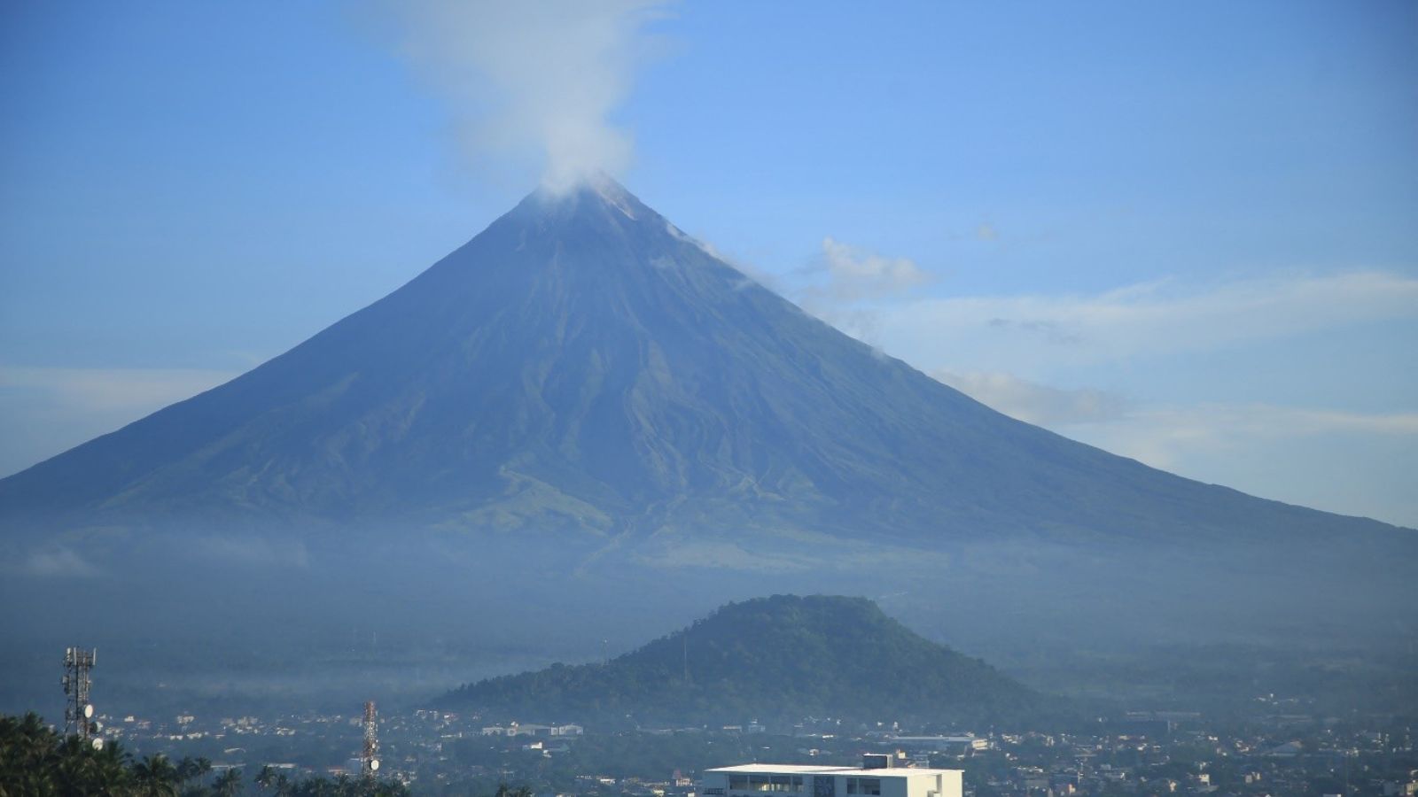
As of 25 February 2026, Mayon Volcano in Albay province continues to exhibit eruptive activity characterized by ash emissions, rockfalls, and pyroclastic density currents (PDCs). Alert Level 3 remains in effect, with a six-kilometre permanent danger zone enforced. Activity patterns since January indicate recurrent short explosive pulses and intra-crater dome growth-collapse cycles, increasing the likelihood of intermittent ashfall and localized PDCs over the coming one to four weeks. Downwind municipalities, particularly toward the southeast, face repeated ash deposition depending on wind direction. Rainfall may elevate lahar risk along river channels. The current risk profile reflects sustained localized hazard rather than imminent catastrophic summit collapse, though episodic escalation remains plausible.
Known Hotspots & Sensitive Zones
- High-impact zones: Six-kilometre permanent danger zone; barangays in Camalig, Guinobatan, Daraga, and Ligao; upper river channels prone to lahars; slopes facing southeast where ash drift is recurrent.
- Medium-impact areas: Legazpi City urban districts; Bicol International Airport (Daraga); Maharlika Highway segments exposed to ash accumulation and runoff.
- Low-impact areas: Municipalities outside primary ash plume direction and beyond lahar-prone catchments.
Mayon has a documented pattern of frequent small-to-moderate eruptions, with historical precedent for lethal PDCs and destructive lahars.
Impact on Transportation & Services
Ashfall has reduced visibility on segments of the Maharlika Highway, prompting intermittent road advisories and clearance operations. Access roads within the six-kilometre zone remain restricted. Bicol International Airport has experienced operational advisories, and potential flight delays due to volcanic ash in regional airspace. Local bus services and cargo transport face rerouting during ash or lahar episodes. Utility networks may experience localized outages due to ash accumulation on power lines and water system contamination. Businesses in Legazpi and Daraga should anticipate workforce displacement, tourism suspension, and supply chain delays.
Recommended Action
- Organizations should activate volcano response protocols and verify personnel status in affected municipalities.
- Enforce mandatory evacuation compliance within designated danger zones and provide PPE, including N95 masks and eye protection, in ashfall areas.
- Seal HVAC systems and protect critical equipment from ash infiltration.
- Reroute logistics around affected highways and monitor aviation advisories before dispatching air cargo.
- Maintain liaison with PHIVOLCS, local disaster management councils, and aviation authorities.
- Strategically, businesses should diversify supply routes, pre-identify alternate operational sites, and review insurance and regulatory compliance obligations.
Multi-Dimensional Impact
Ongoing evacuations may strain local governance capacity, affecting parallel civil activities and heightening community tensions if resource distribution becomes uneven.
Emergency Contacts
- Emergency Number: 911
- PHIVOLCS Volcano Monitoring Updates: phivolcs.dost.gov.ph/
Situational Outlook
The baseline scenario anticipates continued intermittent ash emissions, rockfalls, and localized PDCs over the next 72 hours with Alert Level 3 maintained and exclusion zones enforced. A moderate escalation within the next seven days could involve stronger explosive pulses, intensified ashfall over Legazpi and Daraga, and rain-triggered lahars causing extended road and airport disruption. A severe escalation, though lower probability, would involve a larger explosive event or sustained dome collapse producing extensive PDC reach, widespread ashfall, expanded evacuations, and multi-day transport and infrastructure shutdowns across Albay. Current indicators support sustained elevated volcanic activity requiring continuous monitoring through early March.
Strategic Takeaway
Mayon Volcano’s ongoing eruption presents a high-impact localized natural disaster risk with implications for aviation, public safety, infrastructure resilience, and regional supply chains. While catastrophic escalation is not currently indicated, persistent ashfall and PDC hazards necessitate strict compliance with exclusion zones and proactive business continuity planning. Organizations operating in Albay should prioritize life safety, asset protection, and real-time situational awareness. Stay ahead of operational risks with real-time alerts, scenario modeling, and expert advisories with datasurfr’s Predict. Start your 14-day free trial of Datasurfr’s Risk Intelligence Platform today.
