Executive Summary for the Evacuations in Dunedin
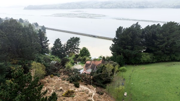
A landslip in Dunedin has led to localized evacuations and road closures in the Musselburgh area. Emergency services have restricted access while geotechnical assessments and stabilization measures are conducted. Disruption is expected to remain localized but may persist for several days, with potential follow-on remediation works.
- Event Date: 18 February
- Location: Portobello Road, Musselburgh, Belmont Lane, Dunedin, New Zealand
- Risk Category: Natural Disasters
- Severity Level: 3 / 5
- Confidence Score: 75 %
Operational Context
Shallow landslips in Dunedin and wider Otago are frequently associated with prolonged rainfall, saturated ground conditions, and slope instability. Historical precedent indicates that the most acute operational disruption typically lasts 24–72 hours while emergency response, geotechnical inspections, and temporary stabilization are undertaken. However, access restrictions and remediation work often extend for one to three weeks where structural reinforcement or drainage correction is required. The affected Musselburgh and southern Dunedin corridor includes residential properties and key local access roads, increasing exposure to travel disruption, asset damage, and utility stress. Secondary risks include further soil movement if additional rainfall occurs within the next 72 hours.
Known Hotspots & Sensitive Zones
- High Impact Zones: Immediate slip zone around Musselburgh and adjacent sections of Portobello Road and Belmont Lane, where evacuations and restricted access are in place.
- Medium Impact Zones: Neighbouring residential streets and feeder roads connecting to Highcliff Road and southern Dunedin corridors, where detours and increased traffic loads are likely.
- Low Impact Zones: Central Dunedin and broader Otago region, unless further slope failures occur.
Dunedin has a history of weather-driven slope failures and localized flooding, with recurrence risk elevated following heavy rainfall and ground saturation.
Impact on Transportation & Services
Road closures have resulted in detours for private vehicles and local bus services, increasing journey times and limiting access to affected neighbourhoods. Freight and last-mile deliveries in southern Dunedin may experience short-term delays. Soil displacement may impact kerbing, stormwater systems, and underground utilities, though no widespread infrastructure collapse has been reported. Businesses in the immediate vicinity face reduced customer footfall and limited site access. Communications and IT networks remain operational, but localized utility inspections are underway as a precaution.
Recommended Action
- Organizations should activate a localized incident response protocol, confirm staff safety, and implement temporary remote-work arrangements for affected employees.
- Secure physical assets near unstable slopes and restrict non-essential site access.
- Coordinate with Dunedin City Council and emergency services for verified updates and adhere strictly to evacuation and road-closure notices.
- For logistics operators, reroute deliveries via unaffected corridors and communicate revised ETAs to clients.
- Longer-term, conduct slope-risk assessments for properties in vulnerable zones and review business continuity plans addressing natural disaster and landslip scenarios.
Multi-Dimensional Impact
Additional rainfall within the next 72 hours could trigger further slope instability, extending evacuations and road closures. Emergency resource allocation to the slip area may temporarily reduce response flexibility for unrelated incidents.
Emergency Contacts
- Emergency Number: 111
- MetService: metservice.com/
Situational Outlook
The most probable trajectory over the next 24–72 hours involves continued geotechnical assessment and stabilization, followed by phased reopening of affected roads once deemed safe. A moderate escalation scenario would involve further rainfall or identification of broader subsurface instability, extending evacuations and remediation works for up to one to two weeks. Severe escalation remains unlikely but could arise if cascading slope failures affect adjacent streets, requiring longer-term infrastructure repair. Overall, disruption is expected to remain localized, though sustained monitoring of weather patterns and ground conditions is essential.
Strategic Takeaway
The Dunedin landslip represents a localized but material natural disaster risk affecting residential safety, travel mobility, and access to utilities. While city-wide infrastructure failure is not indicated, slope instability warrants continued vigilance. Businesses and local authorities should prioritize geotechnical monitoring, contingency routing, and proactive communication. Stay ahead of operational risks with real-time alerts, scenario modeling, and expert advisories with datasurfr’s Predict. Start your 14-day free trial of Datasurfr’s Risk Intelligence Platform today.
