Executive Summary for the Heavy Swell Warnings in New Zealand
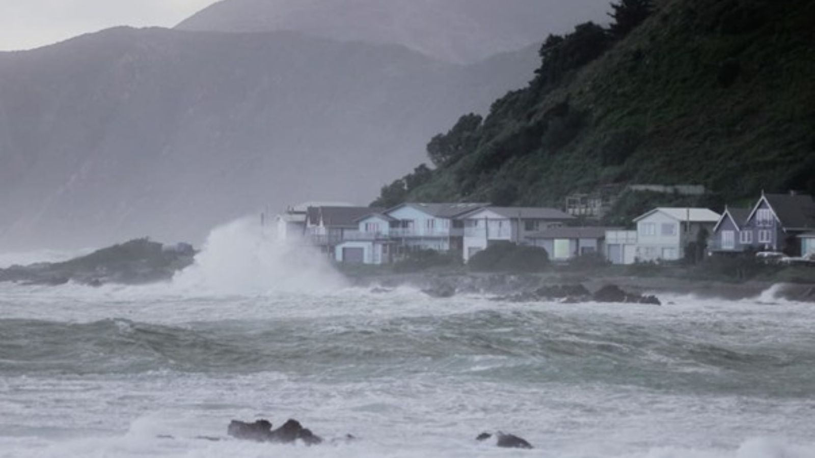
MetService has issued heavy swell warnings through 17 February for exposed coastal areas of the lower North Island. Anticipated impacts include hazardous surf, coastal flooding in low-lying zones, ferry cancellations across Cook Strait, and localized infrastructure strain. Severity is moderate with elevated localized risk near cliffs, beaches, ferry terminals, and coastal roads.
- Event Date: 16 February
- Location: Wairarapa and Wellington, New Zealand
- Risk Category: Environment
- Severity Level: 3 / 5
- Confidence Score: 78 %
Operational Context
Heavy swell events affecting the lower North Island typically arise from strong southerly or southwest storm systems generating prolonged wave energy across Cook Strait and adjacent coastlines. Historically, similar advisories have led to hazardous breaking surf, coastal erosion, and ferry disruptions between Wellington and inter-island routes. Impacts concentrate along exposed headlands, harbour entrances, and low-lying waterfront infrastructure. The primary operational window is expected to span 24–96 hours, with peak risk aligned to high tide cycles and onshore wind intensification. Previous events in Wellington and along the Kapiti and Wairarapa coasts have resulted in road closures, power interruptions, beach evacuations, and emergency rescues.
Known Hotspots & Sensitive Zones
- High-impact zones: Wellington CBD waterfront (Oriental Bay, Queens Wharf), Cook Strait ferry terminals, Miramar and Seatoun headlands, Cape Palliser and Turakirae Head, Kapiti Coast beaches including Paekākāriki and Raumati.
- Medium-impact areas: Coastal sections of State Highway 1 north of Wellington and parts of State Highway 2 near exposed bays, where wave overtopping and debris may occur.
- Low-impact areas: Inland districts beyond direct coastal exposure, though indirect transport disruption is possible.
Heavy swell advisories in this corridor show recurring patterns of ferry disruption, beach closures, and localized power outages during sustained onshore winds.
Impact on Transportation & Services
Cook Strait ferry services are vulnerable to cancellation or delay due to hazardous sea conditions, affecting passenger movement and freight logistics. Coastal roads, including segments of SH1 and SH2, may face temporary closure due to wave overtopping or debris accumulation. Airports in Wellington could experience flight delays if strong winds accompany swell-producing systems. Coastal businesses, tourism operators, and port facilities may suspend operations during peak wave periods. Utility infrastructure near shorelines faces low-to-moderate risk of localized outages.
Recommended Action
- Authorities and businesses should suspend non-essential coastal activities and restrict public access to exposed beaches and headlands.
- Ferry-dependent supply chains should activate contingency routing via road or rail alternatives where feasible.
- Secure loose coastal assets and relocate equipment above projected surge lines.
- Establish an incident coordination cell to monitor MetService advisories and council updates at regular intervals.
- Emergency preparedness agencies and local councils should ensure warning signage, public alerts, and rapid-response teams are positioned for potential rescues.
Multi-Dimensional Impact
Concurrent infrastructure stress, including existing power or water network vulnerabilities, may be exacerbated if coastal inundation restricts repair access or increases debris load on drainage systems.
Emergency Contacts
- Emergency Number: 111
- MetService Weather Warnings Portal: metservice.com/warnings/home
Situational Outlook
The most probable scenario over the next 72 hours involves hazardous surf conditions leading to temporary beach closures, intermittent ferry delays, and localized road restrictions without major structural damage. A moderate escalation could arise if sustained onshore winds coincide with high tide, producing coastal inundation and multi-sailing ferry cancellations. Severe escalation remains less likely but would involve storm surge interaction with peak tidal cycles, resulting in significant coastal flooding, infrastructure damage, and extended transport disruption. Current forecast confidence supports heightened monitoring through 17 February, with residual risk of secondary swell activity beyond this window.
Strategic Takeaway
The heavy swell warning presents a moderate environmental and travel risk concentrated along exposed Wellington and Wairarapa coastlines. Proactive transport contingency planning, coastal asset protection, and public safety messaging are essential to reduce incident likelihood. Stay ahead of operational risks with real-time alerts, scenario modeling, and expert advisories with datasurfr’s Predict. Start your 14-day free trial of Datasurfr’s Risk Intelligence Platform today.
