Executive Summary for the Volcanic Activity at Mayon Volcano
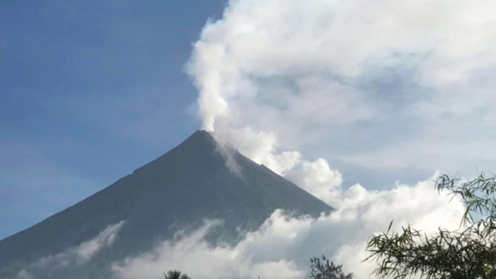
Monitoring authorities reported 133 volcanic earthquakes at Mayon Volcano on 10 March while maintaining Alert Level 3, indicating continued magmatic unrest and active surface processes including lava effusion and rockfalls. The event reflects ongoing volcanic instability with localized hazards for communities and infrastructure within the six-kilometer danger zone. While the current impact remains geographically concentrated, intermittent ash emissions, lahar activity, and advancing lava flows could create temporary disruption to transportation, aviation, and economic activity in surrounding municipalities.
- Event Date: 10 March
- Location: Mayon Volcano, Albay, Philippines
- Risk Category: Natural Disasters
- Severity Level: 3 / 5
- Confidence Score: 75 %
Operational Context
Mayon Volcano in Albay Province remains under Alert Level 3 following persistent volcanic activity characterized by frequent seismic events, lava effusion, and rockfalls from the summit crater. On 10 March, monitoring authorities recorded 133 volcanic earthquakes within the reporting period, reflecting continuing magmatic movement beneath the volcano. Recent monitoring bulletins over the past several weeks have documented recurring clusters of volcanic earthquakes, advancing lava flows, and episodic ash emissions, indicating sustained volcanic unrest. Under Alert Level 3 conditions, hazardous processes such as lava flow advancement, rockfall events, and potential pyroclastic density currents may occur within the established six-kilometer permanent danger zone surrounding the summit. Communities located along known lahar channels, including river systems draining the volcano’s slopes, remain particularly vulnerable during rainfall events that can mobilize volcanic debris. This operational environment presents ongoing risk to local populations, agriculture, transport corridors, and regional aviation operations, particularly if ash emissions intensify.
Known Hotspots & Sensitive Zones
High-impact zones:
- Municipalities and barangays within the six-kilometre permanent danger zone around Mayon
- River drainage systems including Miisi, Bonga, and Quirangay channels
Medium-impact areas:
- Foothill communities in Camalig, Guinobatan, Santo Domingo, and Ligao
- Agricultural areas located along volcanic slopes and drainage basins
Low-impact areas:
- Urban centres outside the immediate volcanic hazard radius
Volcanic hazards at Mayon historically intensify during periods of sustained seismic activity, particularly when rainfall increases the probability of lahars along established drainage channels.
Impact on Transportation & Services
Volcanic activity at Mayon may intermittently disrupt regional transportation and essential services. Ash emissions, when present, can affect aviation operations by prompting advisories or temporary restrictions for flights operating in nearby airspace. Surface transportation may also face disruption due to temporary road closures near the volcano or along lahar-prone river channels. Agricultural and tourism activities within restricted zones remain suspended due to safety advisories, potentially affecting local economic activity. Infrastructure such as rural roads, irrigation systems, and bridges may experience localized damage if ashfall accumulates or lahar flows occur during rainfall events.
Recommended Action
- Authorities and organizations operating in Albay should maintain strict adherence to the six-kilometre exclusion zone and ensure evacuation preparedness for communities located in high-risk areas.
- Emergency planners should monitor volcanic activity updates and coordinate with local disaster management agencies to maintain situational awareness.
- Protective measures such as distributing respiratory protection during ashfall events and restricting travel along lahar-prone river channels are recommended.
- Over the longer term, businesses and local governments should incorporate volcanic hazard scenarios into disaster preparedness and business continuity plans.
- Coordination with national and local emergency response authorities, including disaster risk reduction agencies, will support effective monitoring and response efforts.
Multi-Dimensional Impact
No additional unrelated incidents have been identified that could significantly compound the current volcanic hazard conditions around Mayon.
Emergency Contacts
- Emergency Number: 911
- Philippine Institute of Volcanology and Seismology: phivolcs.dost.gov.ph/
Situational Outlook
Over the coming days to weeks, the most likely scenario involves continued volcanic unrest at Mayon with frequent volcanic earthquakes, sustained lava effusion confined to the summit and upper slopes, and occasional ash emissions. Under this baseline scenario, Alert Level 3 is expected to remain in effect while authorities maintain the established danger zone and issue localized advisories for lahar-prone areas. A moderate escalation scenario may involve increased explosive activity producing higher ash plumes, renewed lava advancement, and expanded precautionary evacuations for selected communities along vulnerable drainage channels. In a lower-probability but higher-impact scenario, a significant escalation in volcanic activity could trigger stronger explosive eruptions and broader evacuation measures, potentially affecting regional transport networks and economic activity for an extended period.
Strategic Takeaway
The continued detection of frequent volcanic earthquakes at Mayon highlights an active and evolving volcanic hazard environment in Albay Province. While current impacts remain concentrated within established danger zones, persistent seismic activity and lava effusion underscore the potential for sudden escalation. Communities, businesses, and authorities should maintain preparedness measures and closely monitor official advisories to reduce exposure to volcanic hazards. Stay ahead of operational risks with real-time alerts, scenario modeling, and expert advisories with datasurfr’s Predict. Start your 14-day free trial of Datasurfr’s Risk Intelligence Platform today.
