What is happening along the India–China border in Arunachal Pradesh?
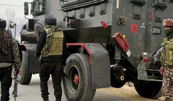
Arunachal Pradesh remains one of the most strategically sensitive areas along the disputed India–China boundary. The latest phase of border friction is concentrated in the Taksing circle of Upper Subansiri district, where differing perceptions of the LAC have contributed to recurring patrol encounters.
According to the MitKat report dated 4 November 2026, the current phase reportedly began with a patrol face-off near Taksing on 25–26 July. Chinese personnel were subsequently reported to have returned in larger numbers and established temporary positions. However, the precise locations and status of these reported positions remain contested.
On 22 October, the ITBP Director General reportedly confirmed that face-offs were continuing at several locations. Despite these developments, the situation remains localised, with no established evidence of a wider military build-up across Arunachal Pradesh.
Military and diplomatic engagement has continued, including the 25th round of Special Representatives’ talks in August, eastern-sector Corps Commander-level talks in September and a Modi–Xi meeting in New Delhi on 12 September 2026.
Which areas of Arunachal Pradesh face the highest security risks?
The report identifies Upper Subansiri as the area with the highest exposure to current border friction.
Key locations include:
- Taksing: The epicentre of the 2026 face-offs and a high-risk area.
- Asaphila: A longstanding patrolling dispute area with historical significance dating back to the 1962 conflict.
- Maja (Maza): A reported site of the July 2026 encounter, with the Lowa Xincun village located nearby.
- Gelemo: A border village along the Tsari Chu, assessed as medium risk.
- Longju: A historical flashpoint associated with the 1959 incident, also assessed as medium risk.
- Yangtse, Tawang: The site of the December 2022 clash, assessed as medium risk.
Exposure decreases considerably with distance from the LAC. Tawang and Anjaw remain relevant areas for monitoring, while Itanagar, the foothills and Assam supply corridors are assessed as largely unaffected.
For organisations, this geographical distinction is important: the current situation does not indicate state-wide disruption, and operational precautions should be proportionate to proximity to sensitive border areas.
Why are India and China experiencing recurring tensions in Arunachal Pradesh?
The dispute is rooted in competing territorial claims and differing interpretations of the boundary.
India recognises the McMahon Line, established under the 1914 Simla Convention, as its boundary in this sector. China does not recognise the line and claims most of Arunachal Pradesh as part of southern Tibet, referred to as Zangnan.
Several factors continue to contribute to tensions:
- Competing territorial claims: Both countries maintain different positions on sovereignty over the region.
- Unclear LAC alignment: The absence of a mutually agreed understanding of the LAC in certain areas increases the possibility of patrol encounters.
- Military positioning: Temporary camps, patrol activity and changes in deployments can intensify local friction.
- Infrastructure competition: Roads, forward facilities and border settlements improve access and military mobility but can also become sources of confrontation.
- Water security: China’s proposed 60 GW Yarlung Tsangpo (Medog) project and India’s proposed 11,200 MW Siang Upper Multipurpose Project add a strategic dimension to the dispute.
Although border-management agreements and diplomatic mechanisms have helped manage incidents, they have not resolved the underlying territorial disagreement.
How could India–China border tensions affect businesses and logistics?
The most likely commercial consequences are concentrated around border districts rather than the wider Indian economy.
Organisations undertaking construction, infrastructure development, maintenance or fieldwork near the LAC could face delays due to heightened security measures, restricted movement and limited access to project sites.
Logistics operations are particularly exposed. Road closures, security checks and limited alternative routes could delay the movement of fuel, construction materials, machinery and essential supplies. The Gelensiniak–Taksing road is identified in the report as a single point of failure, increasing the vulnerability of projects dependent on this route.
Other potential business impacts include:
- Higher transport, personnel and equipment costs.
- Delays in project execution and contractual commitments.
- Reduced availability of contractors and technical specialists.
- Increased inventory requirements at remote project sites.
- Disruptions to local labour, transport and support services.
The report also highlights potential consequences for local communities, including restricted access to grazing areas, forests, healthcare, education and markets.
Direct targeting of civilians is not indicated in the assessment. However, difficult terrain, limited road connectivity and patchy communications could complicate emergency response and medical evacuation.
What is the outlook for India–China border tensions through 2027?
MitKat assesses the current situation at Level 2 – Persistent Standoff on its five-level escalation scale.
In the near term, continued localised friction is considered the most likely scenario. Military and diplomatic communication may help contain tensions, while winter conditions from December are expected to reduce high-altitude patrolling and the likelihood of physical encounters.
A managed de-escalation remains possible if military meetings and diplomatic engagement improve border management. However, a localised military escalation, involving a physical clash or breakdown in communication, could lead to reinforcements, tighter movement controls and temporary suspension of fieldwork.
Over the next three to twelve months, strategic competition is expected to continue. The report identifies the April–September 2027 patrol season as a potential period of renewed friction, with implications for infrastructure development, logistics and investment decisions in border districts.
For businesses, the primary concern is therefore not an immediate wider conflict but recurring uncertainty, access restrictions and higher operating costs in sensitive border areas.
Frequently Asked Questions
1. Is there an ongoing India–China military standoff in Arunachal Pradesh?
The MitKat report dated 4 November 2026 describes continuing, localised face-offs in the Taksing sector of Upper Subansiri district. It does not establish a wider military build-up or a change in territorial control.
2. Which areas are most affected by India–China border tensions?
Upper Subansiri, particularly Taksing, Asaphila and Maja, has the highest exposure. Tawang and Anjaw are also relevant areas for monitoring, while Itanagar and the Assam supply corridors are assessed as largely unaffected.
3. How should businesses prepare for border-related disruptions?
Organisations should map personnel, facilities and suppliers against sensitive border areas, verify permits, identify alternative routes, maintain contingency stocks and establish employee check-in procedures. They should also monitor official government and security updates and activate business continuity plans if movement restrictions or confirmed escalation occur.
Download the full advisory now
For a detailed assessment of the India–China border situation, including historical developments, key hotspots, scenario probabilities, escalation triggers and business impact, refer to the MitKat Special Report – India–China Border Tensions: Arunachal Pradesh Security Outlook, dated 4 November 2026.
Filed under: APACIndia-South AsiaThreat Intelligence Special Reports