Operational Context
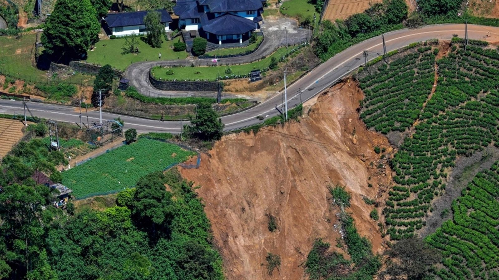
Sri Lanka’s central highlands experience frequent landslides during intense monsoon bursts, particularly in Kandy, Kegalle and Ratnapura. Level III warnings represent the highest risk classification and typically coincide with soil saturation, slope instability and increased vulnerability of hillside settlements. Prior events in these districts have resulted in casualties, destroyed homes, blocked highland routes and multi-day supply-chain delays. Repeated advisories in November–December indicate persistent meteorological conditions, and hazard clusters often remain active for two to five days. Tea estates, small industries and community infrastructure in valley margins and steep slopes are historically the most affected, and disruptions to medical access and school operations are common. The current warnings require immediate preparedness and proactive safety measures for at-risk populations and organisations operating in these districts.
Executive Summary
- Event Date 08 December 2025
- Location: Uva, Sabaragamuwa and Central Provinces, Sri Lanka
- Risk Category: Natural Disasters
- Severity Level: 4 / 5
- Confidence Score: 78 %
NBRO has issued Level III landslide warnings for Kandy, Kegalle and Ratnapura due to persistent heavy rainfall and saturated slopes. Elevated risk is expected for two to five days, with impacts on hillside settlements, highland transport corridors and essential services.
Known Hotspots & Sensitive Zones
High-Impact Zones: High-risk GN divisions in Kandy (Peradeniya–Gampola belt), Kegalle (Aranayaka, Rambukkana), Ratnapura (Palmadulla–Kuruvita zone.
Medium-Impact Zones: Estate access roads, valley settlements, schools and district hospitals in foothill regions.
Low-Impact Zones: Urban lowlands and coastal districts.
These districts exhibit seasonal recurrence during monsoon cycles and contain historically scarred slopes prone to failure.
Impact on Transportation & Services
Landslides may block major highland routes, including segments of A5 and A7 corridors, restricting inter-district travel and emergency response mobility. Passenger buses on hill routes may face suspensions, while rail services near Peradeniya–Gampola could be disrupted if debris reaches tracks. Power feeders, local water schemes and telecom lines are vulnerable to damage from slope collapse. Business operations, particularly tea estates and district facilities, may experience closures, workforce shortages and delayed deliveries.
Recommended Action
Immediate Measures:
- Activate evacuation protocols for facilities in high-risk GN divisions.
- Pre-position emergency equipment (sandbags, pumps, generators).
- Relocate high-value stock to safe storage outside affected districts.
- Validate emergency contacts and ensure real-time staff check-ins.
Strategic Measures:
- Establish district-level incident teams with hourly reporting.
- Maintain updated GIS-based hazard maps and coordinate with local DMC and NBRO advisories.
- Implement infrastructure redundancy for power, IT and water systems.
- Prepare post-event geotechnical assessments before reinstating full operations.
Multi-Dimensional Impact
Existing strain on health and education infrastructure, including previously damaged hospitals and schools, may be exacerbated by accessibility issues and extended closures. Rescue operations may be constrained by weather conditions, reducing availability of air support.
Emergency Contacts
- National Building Research Organisation (NBRO): nbro.gov.lk
- Disaster Management Centre (DMC): 117
- Sri Lanka Police: 112
Situational Outlook
Baseline scenario suggests localized slope failures and temporary evacuations; roads cleared within one to two days. Moderate escalation may result in multiple landslides and extended road closures; displacement of communities and week-long disruption to supply chains. Severe outcomes remain unlikely but could involve major slope failures, fatalities and widespread infrastructure damage requiring national-level emergency activation.
Strategic Takeaway
Persistent rainfall and saturated slopes present a high-risk environment across Sri Lanka’s central highlands. Organisations should prioritise people safety, maintain situational awareness and utilise early-warning platforms such as MitKat’s Datasurfr to support response readiness and continuity planning during this elevated hazard period. Stay ahead of operational risks with real-time alerts, scenario modeling, and expert advisories with datasurfr’s Predict. Start your 14-day free trial of Datasurfr’s Risk Intelligence Platform today.
