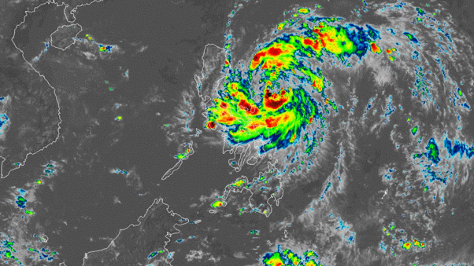
Introduction
The Philippines is once again bracing for severe weather as Severe Tropical Storm Paolo (Matmo) intensifies over Luzon. As of Friday (03 October), Paolo was located around 150 km east of Casiguran, Aurora, carrying maximum sustained winds of 100 km/h near the center, with gusts reaching 125 km/h. Moving west-northwestward at 20 km/h, the storm is expected to make landfall in Aurora or northern Isabela, raising the risk of flash floods, landslides, and widespread transport disruptions.
Current Situation
The Philippine Atmospheric, Geophysical and Astronomical Services Administration (PAGASA) has raised multiple Tropical Cyclone Wind Signals (TCWS):
- Signal No. 3 – Northern Aurora (Dilasag, Casiguran, Dinalungan), central and southern Isabela, and parts of Quirino, Mountain Province, Benguet, Nueva Vizcaya, Ilocos Sur, La Union, and Abra.
- Signal No. 2 – Southern Cagayan, northern and eastern Nueva Vizcaya, and parts of Quirino.
Rainfall exceeding 200 mm has been forecast for Aurora, Isabela, and Quirino, while 100–200 mm is expected across Cagayan, Apayao, Abra, Benguet, and Ilocos provinces. Metro Manila, Laguna, Rizal, and Quezon may also face heavy downpours, leading to urban flooding.
Flight Cancellations and Transport Disruptions
The Civil Aviation Authority of the Philippines (CAAP) confirmed that multiple domestic flights have been canceled due to adverse weather from Severe Tropical Storm Paolo.
- Philippine Airlines suspended flights connecting Manila with Tuguegarao, Cauayan, and Laoag, affecting over 700 passengers.
- Cebu Pacific Air announced cancellations for Manila–Tuguegarao and Manila–Cauayan routes, impacting more than 800 passengers.
Port operations in northern and eastern Luzon may also experience delays, while rough seas and storm surges pose significant risks to fishing and inter-island travel.
Community Impact
Reports indicate that several provinces have already experienced flooding. PAGASA’s heavy rainfall warnings remain in effect, with advisories cautioning of potential storm surges reaching 1–3 meters along exposed coastlines. Urban centers like Metro Manila and Central Luzon face risks of waterlogging, traffic disruptions, and power outages.
Strong winds under TCWS No. 3 may damage light infrastructure, uproot trees, and disrupt electricity supply in Aurora, Isabela, and Quirino. Authorities have urged residents in low-lying areas to prepare for evacuations and to remain alert for sudden landslides in upland communities.
Government and Emergency Response
Local governments have activated their disaster risk management protocols, while the Philippine National Police (PNP) has been deployed to assist in evacuation efforts. The Metropolitan Manila Development Authority (MMDA) has suspended the Expanded Number Coding Scheme to ease traffic amid weather disruptions.
The aviation authority has urged passengers to coordinate directly with their airlines for rebooking and refund procedures. Barangays and local disaster units are on Red Alert, mobilizing relief goods and shelter facilities in case conditions worsen.
Outlook
According to PAGASA, Severe Tropical Storm Paolo is expected to cross northern Luzon on Friday and may emerge into the West Philippine Sea by Saturday (04 October). Re-intensification remains possible once it moves over open waters. Continuous heavy rainfall, aftershocks of flooding, and extended power outages may affect business continuity and supply chain stability in the coming days.
Organizations are advised to closely monitor advisories from PAGASA and the National Disaster Risk Reduction and Management Council (NDRRMC). Preparedness measures such as backup power, adjusted logistics routes, and flexible work arrangements will help mitigate the impact.
Recommendations
- Monitor official PAGASA bulletins: https://www.pagasa.dost.gov.ph.
- Avoid non-essential movement in high-risk provinces including Aurora, Isabela, Quirino, and Cordillera.
- Prepare contingency plans for employee commutes, power outages, and supply chain delays.
- Passengers should confirm flight status before heading to airports and plan for extended travel times due to possible flooding and traffic congestio
Stay Ahead of Threats with Datasurfr Predict
MitKat’s datasurfr delivers accurate, real-time, and contextualised data to help organisations respond swiftly to physical, environmental, and cyber threats.
With Sam AI, our AI Agent not only provides context for unfolding events but also analyses vetted historical data to forecast how events are likely to evolve and their potential impact using industry and location-specific probabilistic scores. Book a free demo today and see how datasurfr Predict can transform your risk preparedness.
