What is the Mumbai monsoon 2026 outlook and when does the season begin?
The India Meteorological Department (IMD) forecasts the 2026 southwest monsoon to reach Mumbai around 5–6 June, roughly five days ahead of the normal onset date of 11 June. The season is expected to be below normal at 92 percent of the Long Period Average, driven by developing El Niño conditions, with IMD assigning a 35 percent probability to a deficient season and 31 percent to a below-normal one. A lower total does not mean lower risk: Mumbai’s flooding comes mainly from short, high-intensity episodes that can exceed 100–200 mm within three to six hours, particularly when they coincide with high tide. The IPCC also ranks Mumbai among the world’s most sea-level-vulnerable coastal megacities, and any cyclonic circulation tracking toward Maharashtra during high tide would compound flood severity.
Which areas of Mumbai are most exposed to flooding and transport disruption?
The BMC has identified 496 flood-prone spots, up from 453 in 2025, with around 150 in South Mumbai, including newly added high-footfall locations such as Oval Maidan, Churchgate, Metro Cinema junction, Mantralaya, Kemps Corner and Hutatma Chowk; 403 have been addressed, while 93 remain at risk during very heavy rainfall. Other recurrent hotspots include Hindmata, Dadar, Parel, Kurla, Sion, Andheri and Bhandup, with coastal inundation risk along Marine Drive, Worli Sea Face and Juhu. On rail, the stretch from Ghatkopar to Parel on Central Railway and the approaches to Dadar and Bandra on Western Railway flood most often, while the Harbour Line at Chunabhatti and Wadala is vulnerable when rain meets high tide. The Western Express Highway near Vile Parle, Andheri and Malad, the Eastern Express Highway near Ghatkopar and Vikhroli, and LBS Marg in Kurla and the Sion–Panvel Highway near Mankhurd and Chembur face gridlock, Bandra–Worli Sea Link approach roads are affected at high tide, and subways at Andheri, Khar, Milan and Malad are routinely closed, forcing BEST bus diversions. Heavy downpours can also trigger holding patterns, diversions and aborted landings at Chhatrapati Shivaji Maharaj International Airport, and Metro Line 3’s underground stations are sensitive to water ingress.
How prepared is Mumbai after the August 2025 floods?
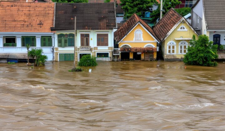
Mumbai recorded nearly 800 mm of rain between 16 and 19 August 2025, roughly a month’s rainfall in four days, with the Mithi River breaching its 4-metre danger line, Central Railway services disrupted between Ghatkopar and Matunga, and nine flights aborting landings on 18 August. For 2026, the BMC is deploying around 547 dewatering pumps, up from 417 in 2025, monitored through IoT systems from a central control room, and has partnered with IIT Bombay on a ward-level early warning system giving rainfall alerts 48 hours ahead instead of three to four. Three NDRF teams will stay on standby, and a 24×7 Disaster Control Room will operate from 25 May to 15 October 2026. Desilting remains uneven, however: major western suburban drains stand at 45 percent completion, eastern corridors at 26 percent and critical Mithi River sections at 27 percent.
What are the business continuity risks during the Mumbai monsoon 2026?
The principal operational risk is intermittent but severe disruption on extreme-rainfall days rather than continuous disruption through the season. Rail, expressway and subway closures can strand staff and delay logistics at the same time, particularly across low-lying commercial districts such as Nariman Point, Lower Parel and the Bandra-Kurla Complex, and settlements near industrial and logistics corridors such as Dharavi, Govandi, Mankhurd and Kurla East, where workforce disruption and slow post-flood recovery are likely. Sea level amplifies the problem: 45 of the city’s 186 stormwater outfalls discharge below mean sea level and rely on low tide, and the drainage network was designed for roughly 25 mm per hour. Power, water and telecommunications outages, sewage overflow and a rise in dengue and other mosquito-borne diseases add to the exposure, while below-normal rainfall may strain reservoirs, with the BMC already imposing precautionary water cuts.
What should organisations and individuals do to prepare?
Organisations should review evacuation plans and identify assembly points on higher ground away from drains and subways, move critical IT infrastructure such as servers and UPS systems to higher floors, and arrange backup power and standby communications. They should also audit electrical installations, document drainage and car-park maintenance, confirm that insurance covers flood and high-tide damage, diversify logistics routes away from LBS Marg and the Western Express Highway, and consider flexible working on red-alert days. Individuals should learn the flood- and landslide-prone areas near them, avoid driving or wading through waterlogged roads, keep clear of downed wires, avoid beaches during high tide and red alerts, drink only sealed water, and follow IMD Mumbai, the BMC Disaster Management Department and Mumbai Traffic Police on X.
Frequently asked questions
When is the monsoon expected to reach Mumbai in 2026?
Around 5–6 June 2026, about five days ahead of the normal 11 June onset, in a season IMD expects to finish below normal at 92 percent of average.
Are Mumbai’s subways and expressways closed during heavy monsoon rain?
Yes. Subways at Andheri, Khar, Milan, Malad and Dahisar are routinely closed in heavy rain, and the Western Express Highway near Vile Parle, Andheri and Malad floods rapidly and often shuts down.
What are the emergency contact numbers for Mumbai during the monsoon?
Nationwide: All-in-One Emergency 112, Police 100, Fire 101, Ambulance 102. Mumbai: BMC Disaster Control Room 1916 (WhatsApp +91-8999228999); Mumbai Traffic Police Control Room 22822631; City District Disaster Control Room 22664232; Suburban District Disaster Control Room 69403344.
Download the full advisory now
datasurfr’s Special Advisory on the Mumbai monsoon 2026 carries the complete flood-prone area maps, transport vulnerability analysis, BMC mitigation measures and a detailed contacts directory. Download the full advisory now to brief your travel and continuity teams.
Filed under: India-South AsiaThreat Intelligence Advisories