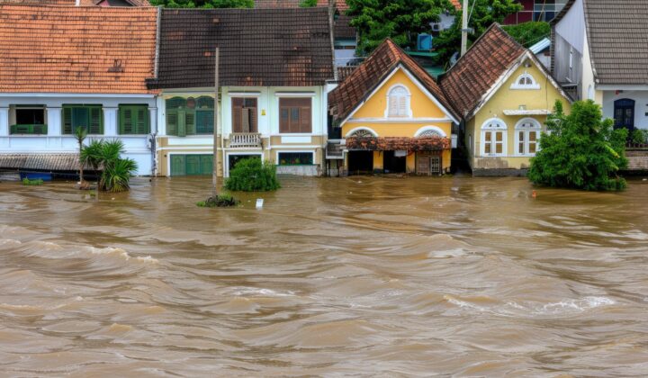
What caused the Bangkok floods 2026 and how severe are they?
Heavy rain fell from the afternoon of 24 September to 27 September, with more than 300 mm recorded in Bangkok and over 330 mm in some areas, associated with an active low-pressure system and a relatively strong southwest monsoon. The Thai Meteorological Department tracked the system across the East and Central regions, and by 28 September it had moved into the Gulf of Martaban. Drainage and canal capacity was overwhelmed, particularly in eastern Bangkok, and all 50 districts were designated flood-affected. Severity is rated High for the urban flood, with an advisory window from 24 September to 02 October 2026, and the status is rain-easing with the drainage phase active. Further showers remain possible and could slow the recession of water.
Which areas and roads in Bangkok are worst affected?
Lat Krabang, Bang Kapi, Khan Na Yao, Sai Mai, Suan Luang, Saphan Sung, Lak Si, Nong Chok and Min Buri remain the most affected districts, with eastern Bangkok the focus of drainage. Nine major roads remain significantly flooded in sections: Ramkhamhaeng, Sena Nikhom, Srinagarindra, Lat Phrao, Ngam Wong Wan, Nakkila Laem Thong, Sihaburanukit, Nuan Chan and Phetchaburi. Depths of up to 47.5 centimetres were reported on sections including Pattanakan Road, Lat Phrao 122 Road and Nawamin Road. Sections of five roads have reopened, including parts of Lat Phrao, Chaeng Watthana, Ram Inthra, Phetchaburi and Nawamin, and Vibhavadi Rangsit Road is more passable. The Bangkok Metropolitan Administration is running pumps at full capacity to lower Khlong Saen Saep, Lat Phrao, Prawet Buri Rom and Prem Prachakorn, so water will recede progressively rather than uniformly. Nonthaburi, Pathum Thani and Samut Prakan also report significant flooding, and levels remain a concern in Ayutthaya.
What is the status of airports and public transport?
Suvarnabhumi Airport is operational with flights running normally, but road access through Lat Krabang is affected; travellers are advised to use Motorway 7 or the Burapha Withi Expressway, or the Airport Rail Link. Allow at least three hours for international and two hours for domestic flights. At Don Mueang, the Tollway and SRT Red Line provide access while metered taxis are temporarily unavailable. U-Tapao International Airport is on full-time readiness through 04 October as an alternate for weather diversions. The BTS Skytrain, MRT, Airport Rail Link and SRT Red Line are operating, while the SRT Eastern Line runs modified services, with eight trains starting or terminating at Ban Thap Chang. Buses and minibuses serving flooded eastern districts may face delays or diversions, and water-based services may be affected by high canal levels.
What are the business continuity risks?
Sector exposure is Medium for road access, canal and river levels, low-lying communities and weather, and Low for business operations, airport transfers, public transport and central Bangkok. Impact from the Bangkok floods 2026 is therefore concentrated in the east: employees living in severely affected areas may struggle to reach workplaces, deliveries, supply chains and customer access remain disrupted, and travel to and from Lat Krabang, Min Buri, Nong Chok and the Suvarnabhumi corridor is unreliable. Central Bangkok, including the Queen Sirikit National Convention Centre, has no current flooding and is reachable by MRT, but wider road conditions could still affect hotel, airport and venue transfers ahead of the IMF Annual Meetings on 12–18 October. Elevated canals, Chao Phraya Dam discharge of 1,950 cubic metres per second and high tides could reverse recovery if heavy rain returns.
What should organisations and individuals do to prepare?
Organisations should activate business continuity procedures, review flood conditions daily using BMA, DDPM, RID and TMD updates, and account for all staff and contractors, particularly those in Lat Krabang, Min Buri, Nong Chok and Bang Kapi. Maintain flexible attendance and remote work, avoid routing staff through flooded areas, review supplier and courier routes serving eastern Bangkok and the airport corridor, and inspect facilities for water ingress and electrical hazards. Confirm airport and event transfers with buffer time and contingency vehicles. Individuals should avoid non-essential travel through flooded corridors, never drive or walk through floodwater, avoid submerged electrical infrastructure, protect documents and medication, keep a charged phone and use rail where practical.
Frequently asked questions
How long will the Bangkok flooding last?
The advisory window runs from 24 September to 02 October 2026; rain has eased but scattered thunderstorms are forecast from 29 September to 04 October, so recession will be gradual and uneven, led by canal levels.
Are Bangkok’s airports open?
Yes. Suvarnabhumi and Don Mueang are operating, although road access through Lat Krabang is affected; U-Tapao is on readiness through 04 October as an alternate.
What are the emergency contact numbers in Bangkok?
BMA hotline (flooding) 1555, medical emergency 1669, Police 191, Tourist Police 1155, TAT Contact Centre 1672, DDPM 1784, SRT 1690, Suvarnabhumi Airport +66 2 132 1888, Don Mueang Airport +66 2 535 1192.
Download the full advisory now
Datasurfr’s Special Advisory on the Bangkok floods 2026 carries the complete road, canal and district status, transport and airport guidance, watch indicators and business continuity checklist. Download the full advisory now to brief your travel and continuity teams.
Filed under: APACThreat Intelligence Advisories